53 Interesting Facts About The Number 53 #12: First 53 Miles of the Pacific Crest Trail

The first 53 miles of the Pacific Crest Trail from Mexico to Canada start just a mile or so south of the small, spread out town of Campo and end at the windy Pioneer Mail Picnic area in the Laguna Mountains.
I am hiking these 53 miles from Saturday March 28 to Tuesday March 31. Thirty years ago, in 1985 I hiked all of California, so this is an anniversary hike of sorts.
Saturday March 28 I hiked 20 dry hot miles south through the desert from Lake Morena to the border. Details to come here.
Sunday March 29 I woke in my vw van in the campground to the sounds of Flying Fish preparing for his buddy to drive him to the border to start his hike. I considered packing up so I too could hike in the cool of the desert morning but once they drove off, I fell back asleep until the cheerful voices of children woke me.
It felt so good to stretch and stay snuggled in my down comforter–it was in the 40s outside. Why get up and hike anyway? What was this crazy idea?
I could hear the sounds of tents being taken down, the click clack of the tent poles snapping back into place. My van felt even cozier than ever, my stove even more convenient. I pulled on long underwear, down jacket, hat and Ugg boots, put the kettle on, and walked over to the other PCTers still in camp at the late hour of 8am.
“Who wants coffee?” I asked. “I don’t have cream but I do have fresh grounds for a french press!” A chorus of “me” reassured me and I went back to brew it, and then join the crew at the table to share more stories about life on various trails, and the endless comparisons of gear.
Like me, siblings Amy and Chris sport Brooks Cascadias in their remarkably loud colors, but everyone was wearing trail runners instead of the full grain leather Norwegian welt 5 pound monsters we all wore 30 years ago.
By 11:30am, most of us had had showers and were packed up if not already gone. I shoved off around noon to find a confusing maze of trails with the obvious one having such a faded PCT marker that I barely recognized it.
Although there was some high clouds, the sun blazed down and temperatures were in the mid-80s. The trail skirts the edge of the dried lakebed with a sandy tread with occasional tree cover, then begins to climb through chaparral which also offers little in the way of shade–but a wealth of fragrant shoulder high shrubs of blue/purple/periwinkle mountain lilac (ceanothus) as well as lower to the ground contrasting scarlet and red penstamen and orange paintbrush.


Climb enough and a breeze may find you as well as views, and then a quick descent and I was passing under a bridge marked sadly by PCTer graffiti. Green grass in the bottom of the canyon hinted at moisture but the creek was dry.
While hot and arid, the six miles north from Lake Morena to Boulder Oaks Campground went quickly; most of the trail is relatively flat without much distraction. I arrived at the campground about 2:30p, dumped my pack on a table, and took off my shoes and socks and washed my feet and legs in the cold water coming from the faucet. I drank and drank, washed the dried sweat and sticky sunscreen from my face, and doused my bandanas and my knee brace in water to drape on my body to bring my temperature down. My knee really started to hurt so I lay down on the bench of the picnic table and elevated my legs. I took some OTC pain meds with some food, and laid down again. In all, I hung out there for three hours, drinking lots of water; I peed more time then than I did the entire previous day’s hike.
About 5pm, I spied Barb Fox and hollered for her to head my way; she and Roland joined me at my table and she began doctoring up his blisters.

Yep, he had some mighty bad blisters.
We also spied on a black plastic garbage bag that someone left on a rock. Disgusted that someone hadn’t bothered to walk the short distance to the trash, I decided to do it–but checked the bag first to find inside some sort of tent or fly–and a small solar phone charger. We wondered about their origins and debated what to do with these items–had a PCTer actually forgot them? How far along would this person be? Would he/she have replaced them already? Or quit the trail by now? We had a million questions and no answers, but it did seem clear to us that these were items of value that could easily end up in the trash.
Since I had room in my pack, I stuffed them in and about 6pm, I took my leave and headed up the trail to cross underneath Interstate 8 and then follow Kitchen Creek–but high above it.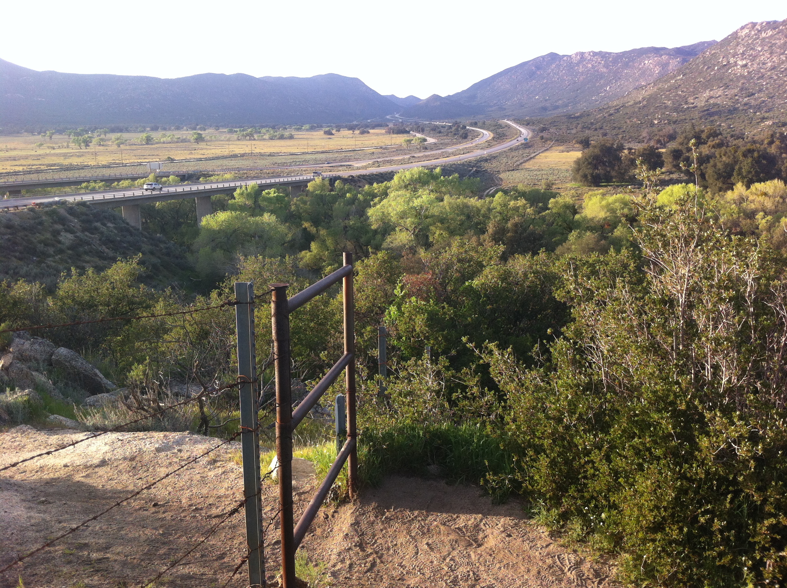
As I climbed the exposed ridge, the evening cooled, the birds began to sing, and the frogs and toads along the creek joined the chorus. The moon rose as the sun set, and just about the time that I would need a headlamp to see, at 7:30pm I arrived at Kitchen Creek Road where I found a nice flat spot. I had no ground cloth, so I laid out the tent I’d found, put my themarest inside, and then collapsed on it before I even filled it with air:
my body was done, my knee was toast, and my hip was comatose.
I found some OTCs and took them. I couldn’t believe how badly my leg hurt–and that it kept feeling worse and worse.
I moaned. I groaned. I whimpered. I rubbed. I rocked. I racked my brain trying to think of something I could do to make it feel better. Sleep was the answer. If I could.
Finally around midnight, my stomach woke me–the pain had subsided enough for me to dig in my bag for some beef jerky. I didn’t even brush my teeth.
Tomorrow March 30, body and mind willing, I will hike 20-22 miles to the Mount Laguna area (which soon you will be able to read about here), and then on Tuesday, March 31, I will hike the rest of the way to Pioneer Mail Picnic Area (which you will be able to read about here).
Note: this was written based on notes and published a few days later.
Discover more from art predator
Subscribe to get the latest posts sent to your email.


